Les Grands Bois
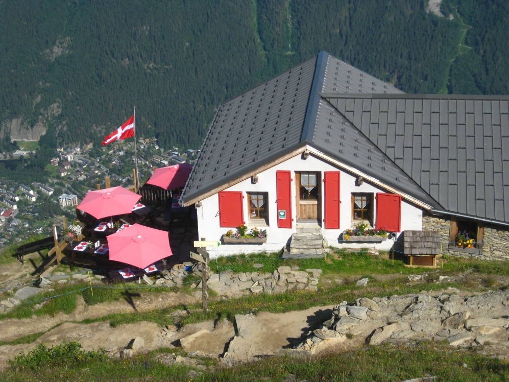
Plan de l’Aiguille refuge
Pleasant climb through the woods to discover the views over the Mont Blanc and the Bossons glacier.
Route start point
CHAMONIX Mont Blanc
Carpark: Grépon carpark.
Free bus to and from “Chamonix Sud” stop.
“Le Mulet” shuttle bus to and from Grépon carpark.
Route start point
CHAMONIX Mont Blanc
Carpark: Grépon carpark.
Free bus to and from “Chamonix Sud” stop.
“Le Mulet” shuttle bus to and from Grépon carpark.
From the Grépon carpark, walk towards the angle close to the ski jump where you will see the signpost and markings for the path. The climb is gradual and pleasant in the cool wood. Shortly after crossing the forest track go right at the next intersection and stay right on the path side which climbs through “Grands Bois” forest.
Half-way up used to stand the small “Des Trois” chalet which refreshed humans and pack mules.
With the path leaves the trees, it winds through rhododendrons and at every moment you can get new views over the Mont Blanc and the Bossons glacier until you finally reach the welcoming terrace of the Plan de l’Aiguille refuge.
There are many paths back down to Chamonix via the Dard waterfall, the Pré du Rocher or the Blaitière mountain pastures.
You can also walk on to the Aiguille du Midi cable car (20min) and ride back down.
The stages of the journey
Book your accommodation
for this hike
stage 1
Refuge du Plan de l'Aiguille
Departure arrival1033 m
Arrival altitude2207 m
Elevation gain/loss1174 m
Time3h00 environ
DifficultyDifficult
Season